(IN-DEPTH HOT TOPIC) WHY ASSAM IS FLOODING EVERY YEAR?
(IN-DEPTH HOT TOPIC) WHY ASSAM IS FLOODING EVERY YEAR?
Context :
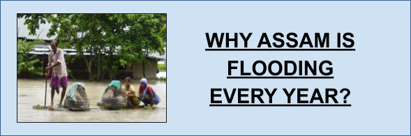
Assam is facing a second wave of flood in July after its first wave of flood in May this year. It is facing almost 3-4 waves of flood every year through the Brahmaputra river system, which affects most of the parts of Assam. Nearly 35 lakhs of peoples are affected in 26 districts of the state with heavy loss to life & submergence of major parts of the Kaziranga National park.
About Brahmaputra River :
- Originated from Chemayungdung glacier in Tibet (China) known as the ‘Yarlung Tsangpo’ flows through Tibet from west to east, enters Arunachal Pradesh as ‘Dihang (Siang)’, continues to flow in Assam as the Brahmaputra & as the Jamuna in Bangladesh.
- Its main left-bank tributaries are Dibang, Lohit, Dhansiri & Kapili while main right bank tributaries are Subansiri & Manas in India.
- ‘Majuli Island’ is the world’s largest riverine island in Assam surrounded between the channels of Brahmaputra.
- The Brahmaputra is coursing through almost entire Assam barring a few regions of the Karbi Anglong region.
- It is one of the most voluminous (extreme volume & quantity of water) rivers of India.
- Its basin countries are China, India, Bhutan, Bangladesh.
Factors responsible for flooding :
- Heavy rainfall through south-west monsoon & presence of hills in Meghalaya led to falling of rain-bearing winds.
- Natural & man-made reasons contribute to flooding.
- The Brahmaputra brings an excess quantity of water & silt & deposited it in the basin causing the river to overflow.
- It also causes a lot of erosion & flood problems.
- Building dams destroyed the ecology.
- Deforestation.
- Embankments supposed to prevent soil erosion also end up a reason for flooding. Heavy rainfall leads to breaking of embankments.
- The immense growth of habitations along the river banks, it doesn't allow the river to expand during its excess quantity of water.
- Destroying wetlands along the river banks which works like a sponge during flooding to absorb water.
- Climate change leads to heavy rainfall in a relatively less period of time which causes intense rainfall & flooding.
Challenges in capital 'Guwahati' :
- Guwahati mostly flooded during monsoons due to its topography having a shape like 'bowl' which makes it susceptible to waterlogging.
- 'Mission flood control Guwahati' report of the Assam Government mentions that unplanned expansion of the city, encroachment to wetlands, shrinkage of forest cover, low lying areas & rainwater from the surrounding hills of Meghalaya bring flood in the city. But a proper workout to resolve the issue is yet awaited.
What can be done?
- Authorities should make a long term plan to build embankments & regular dredging to control the floods.
- countries can go for integrated basin management which will bring all the basin sharing countries together like India, China, Bhutan & Bangladesh.
- Preventive measures should be taken from all the catchment & basin sharing countries in their respective area, otherwise only working at the last resort when flood strike in Assam is only a defensive measure but not a solution.
Benefit due to flood :
- Due to flooding new alluvial soil constantly get deposited in Assam's flood plain leading to continuous increase & recharge of soil & increase in croplands.
- This benefit is only a fraction of whatever losses Assam is facing every year.
Concerns :
- After more than 65 years of independence, a solution to this repeated problem is still awaited.
- The state is mostly dependent upon the embankments which were introduced in the 1950s when the actual hydrology of most rivers including the Brahmaputra was not well-known.
- The river changes its course very frequently, so it is almost impossible to contain it within the embankments.
- The high-pressure flow of the water constantly pressured the embankments wall & subsequent breakage which need frequent reinforcement.
Embankments :
- It is a long ridge made along the river by soil or rock & used to hold or control the flow of rivers or water bodies which might at times get flooded.
Way Forward :
While India has done tremendous progress in increasing the connectivity with the north-East states, flooding is a repeated problem which still needs a concrete solution. With the growing importance of North-East to India which works as a connecting point with South-East Asia & the rising threat from the neighbouring countries, it is imperative to contain the problem
of flooding. This containment of flooding also helps in achieving most of our goals along with preventing economic & social losses.
MCQs :
- ‘Yarlung Tsangpo’ is the name of ------------------------ river/s. Choose the correct options.
- Dihang
- Brahmaputra
- Jamuna
- Kapili
Option :
1) a
2) b, c
3) a, b, c
4) All of the above
ANSWERS (Only for Course Members)
2) The Brahmaputra flows through ------
a) Arunachal, Assam
b) Meghalaya, Assam, Arunachal
c) All of the above
d) None of the above
ANSWERS (Only for Course Members)
Mains
- Critically analyse the factors responsible for flooding in Assam plains almost every year. Support your reason by examples.
- Some reports are claiming that Majuli island may be submerged in later years due to extent flooding in the Brahmaputra. What can be the preventive measures for these challenges?
© IAS EXAM PORTAL
Printed Study Material for UPSC IAS Exams
Online Coaching for IAS PRELIMS Exam
